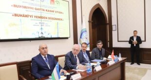
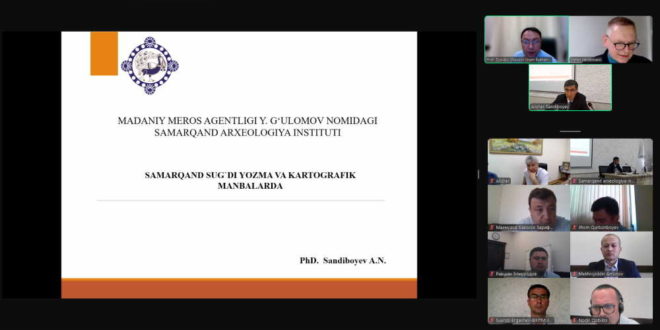
As part of the series “Cultural Treasures of the Zarafshan Valley,” an online seminar was held at the Imam Bukhari International Scientific Research Center in collaboration with the Institute of Asian and African Studies at the University of Hamburg, Germany. The seminar was attended by researchers from the Center, scientific institutions in Uzbekistan and abroad, as well as scholars from countries such as Germany, Turkey, and the United States.
During the seminar, Dr. Alisher Sandiboyev, a senior researcher at the Samarkand Institute of Archaeology named after Yahyo G‘ulomov under the Cultural Heritage Agency and a PhD in History, delivered a lecture titled “Samarkand in Sogdian Written and Cartographic Sources.”
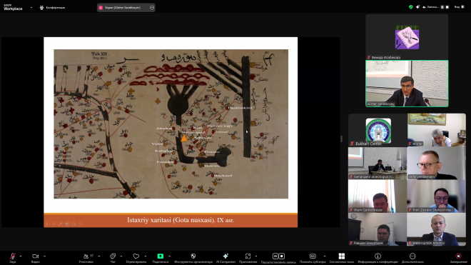
Samarkand was analyzed as a historical-geographical region located in the central part of the Sogdian Zarafshan Valley. To clarify its historical context, a scientific analysis was presented based on Arabic sources and maps, including works by Abu Ishaq al-Farisi al-Istakhri, Abul Qasim ibn Hawqal, Abu Fazl Muhammad ibn Tahir al-Muqaddasi, as well as Abdulkarim al-Sam‘ani and Abu Abdullah Muhammad ibn Muhammad al-Idrisi.
For example, Ibn Hawqal provides the following description of the city of Kushaniya: “Kushaniya is similar in size to Ishtikhan, but it has more villages; its people are wealthy, knowledgeable, and kind.” These lines not only reflect historical documentation but also offer direct insight into the culture and social structure of the time.
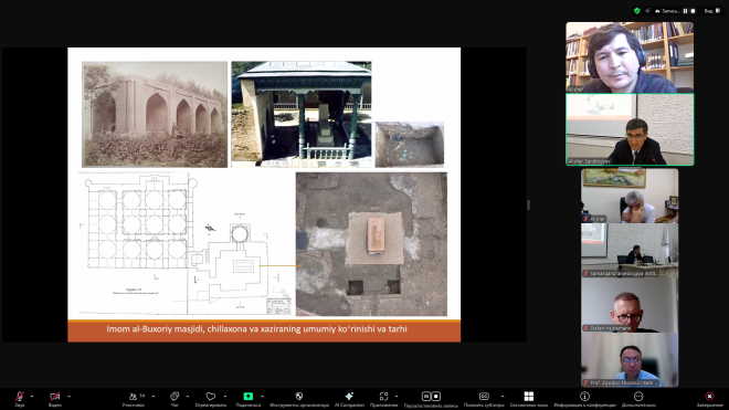
The researcher placed special emphasis on the layout of cities and villages from the 9th to 12th centuries. In particular, he compared the historical locations of cities and settlements such as Ishtikhan, Kushaniya, Dabusiya, Arbinjon, Sogarj, and Razmaz with modern geographical areas. For instance, the historical village of Farankad is believed to correspond to today’s Primkent area in the Oqdaryo district of Samarkand region. Furthermore, referencing Ibn Hawqal’s words – “Canals branched off from the Sogd River to every village, bringing life to the people” – the speaker highlighted the sophisticated irrigation system of the medieval period and its significance in the life of society.
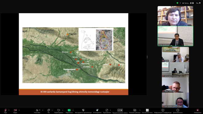
The lecture also provided valuable information about the historical names, borders, and villages of present-day districts such as Urgut, Ishtikhan, Kattakurgan, Oqdaryo, Bulung‘ur, Nurobod, and Baxmal. A scientific analysis of the historical-geographical structure of Samarkand’s western, northern, and southern regions during that era was presented.
In conclusion, the scholar stated: “Through in-depth analysis of written and cartographic sources, the historical geography and cultural heritage of Sogd in the 9th–12th centuries is becoming clearer. This contributes to the scientific restoration of our national heritage in conjunction with current archaeological discoveries.”
Participants emphasized that the lecture would significantly contribute to reviving historical regions and enhancing interest in national identity and cultural heritage.